![](/images/other/stat-length.png)
![Percorso A piedi Bad Endbach - Wanderweg E9 / Hinterländer Schweiz - Photo](https://media.geolcdn.com/t/1900/400/ext.pjpeg?maxdim=2&url=https%3A%2F%2Fmedia.geolcdn.com%2Ff%2F767d0355-412c-449d-99be-38e94380dd15.jpeg)
Wanderweg E9 / Hinterländer Schweiz
SityTrail - itinéraires balisés pédestres
Tous les sentiers balisés d’Europe PRO
![Lunghezza](/images/other/stat-length.png)
Lunghezza
15,9 km
![Altitudine massima](https://static1.geolcdn.com/siteimages/upload/files/1508320355ic_sort_altitude_max_24dp.png)
Altitudine massima
434 m
![Dislivello positivo](https://static1.geolcdn.com/siteimages/upload/files/1508320355ic_sort_den_pos_24dp.png)
Dislivello positivo
327 m
![Km-Effort](/images/other/stat-length.png)
Km-Effort
20 km
![Altitudine minima](https://static1.geolcdn.com/siteimages/upload/files/1508320355ic_sort_altitude_min_24dp.png)
Altitudine minima
238 m
![Dislivello negativo](https://static1.geolcdn.com/siteimages/upload/files/1508320355ic_sort_den_neg_24dp.png)
Dislivello negativo
387 m
![Boucle](https://static1.geolcdn.com/siteimages/upload/files/16400158638029165_repeat_loop_refresh_sync_direction_icon.png)
Boucle
No
Tag
Data di creazione :
2022-02-11 13:14:19.574
Ultima modifica :
2022-02-11 13:14:19.574
![A piedi](https://static1.geolcdn.com/sitytour/trail-icons/100.png)
4h38
Difficoltà : Medio
![Scannerizza questo codice QR per aprire il percorso nell'applicazione SityTrail](https://capi.geolives.com/qq0zvz2zws4bq2lad0pu/sitytour/trails/3089644/qr.png?size=200)
Applicazione GPS da escursionismo GRATUITA
Chi siamo
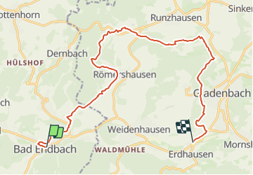
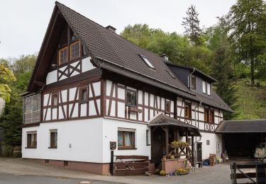
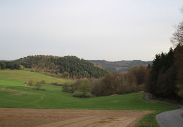
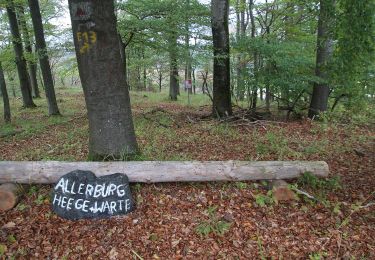
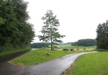
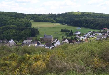
Percorso A piedi di 15,9 km da scoprire a Assia, Landkreis Marburg-Biedenkopf, Bad Endbach. Questo percorso è proposto da SityTrail - itinéraires balisés pédestres.
Descrizione
Trail created by Gemeinde Bad Endbach.
Localizzazione
Paese:
Germany
Regione :
Assia
Dipartimento/Provincia :
Landkreis Marburg-Biedenkopf
Comune :
Bad Endbach
Località :
Unknown
Partenza:(Dec)
Partenza:(UTM)
464396 ; 5622402 (32U) N.
Commenti
Percorsi nelle vicinanze
![Percorso A piedi Bad Endbach - Extratour Viertälerweg - Photo](https://media.geolcdn.com/t/375/260/ext.jpg?maxdim=2&url=https%3A%2F%2Fmedia.geolcdn.com%2Ff%2F767d0355-412c-449d-99be-38e94380dd15.jpeg)
![A piedi A piedi](https://static1.geolcdn.com/sitytour/trail-icons/100.png)
Extratour Viertälerweg
A piedi
Medio
Bad Endbach,
Assia,
Landkreis Marburg-Biedenkopf,
Germany
![](/images/other/stat-length.png)
16,3 km | 23 km-effort
5h 18min
![](https://static1.geolcdn.com/siteimages/upload/files/16400158638029165_repeat_loop_refresh_sync_direction_icon.png)
Sì
![Percorso A piedi Gladenbach - [G12] - Rundweg Gladenbach - Ruine Blankenstein - Kehlnbach - Römershausen - Rachelshausen - Runzhausen - Schutzhütte Kehlnbach - Gladenbach - Photo](https://media.geolcdn.com/t/375/260/ext.jpg?maxdim=2&url=https%3A%2F%2Fmedia.geolcdn.com%2Ff%2F9a55fbee-7b56-4a3a-8921-e1e04f3645be.jpeg)
![A piedi A piedi](https://static1.geolcdn.com/sitytour/trail-icons/100.png)
[G12] - Rundweg Gladenbach - Ruine Blankenstein - Kehlnbach - Römershausen - ...
A piedi
Facile
Gladenbach,
Assia,
Landkreis Marburg-Biedenkopf,
Germany
![](/images/other/stat-length.png)
12,5 km | 16,9 km-effort
3h 50min
![](https://static1.geolcdn.com/siteimages/upload/files/16400158638029165_repeat_loop_refresh_sync_direction_icon.png)
Sì
![Percorso A piedi Gladenbach - [G2] - Rundweg Gladenbach - Bruchmühle - Sportplatz Erdhausen - Koppe - Mornshausen - Gladenbach - Photo](https://media.geolcdn.com/t/375/260/ext.jpg?maxdim=2&url=https%3A%2F%2Fmedia.geolcdn.com%2Ff%2F0190eb51-e3e1-4683-bae1-1b15eaf6b48c.jpeg)
![A piedi A piedi](https://static1.geolcdn.com/sitytour/trail-icons/100.png)
[G2] - Rundweg Gladenbach - Bruchmühle - Sportplatz Erdhausen - Koppe - Morns...
A piedi
Facile
Gladenbach,
Assia,
Landkreis Marburg-Biedenkopf,
Germany
![](/images/other/stat-length.png)
8,3 km | 12,2 km-effort
2h 46min
![](https://static1.geolcdn.com/siteimages/upload/files/16400158638029165_repeat_loop_refresh_sync_direction_icon.png)
Sì
![Percorso A piedi Bad Endbach - Spazierrundweg Zur Hintermühle - Photo](https://media.geolcdn.com/t/375/260/ext.jpg?maxdim=2&url=https%3A%2F%2Fmedia.geolcdn.com%2Ff%2Fb77e9418-cbfd-4c9e-b2bb-3ce410d92990.jpeg)
![A piedi A piedi](https://static1.geolcdn.com/sitytour/trail-icons/100.png)
Spazierrundweg Zur Hintermühle
A piedi
Facile
Bad Endbach,
Assia,
Landkreis Marburg-Biedenkopf,
Germany
![](/images/other/stat-length.png)
3,5 km | 4,7 km-effort
1h 4min
![](https://static1.geolcdn.com/siteimages/upload/files/16400158638029165_repeat_loop_refresh_sync_direction_icon.png)
Sì
![Percorso A piedi Siegbach - Wanderweg E15 / Schlossbergweg - Photo](https://media.geolcdn.com/t/375/260/ext.jpg?maxdim=2&url=https%3A%2F%2Fmedia.geolcdn.com%2Ff%2F3011df58-f1b6-4c76-8bd2-2a6b0ff65fd5.jpeg)
![A piedi A piedi](https://static1.geolcdn.com/sitytour/trail-icons/100.png)
Wanderweg E15 / Schlossbergweg
A piedi
Facile
Siegbach,
Assia,
Lahn-Dill-Kreis,
Germany
![](/images/other/stat-length.png)
5,5 km | 7,9 km-effort
1h 48min
![](https://static1.geolcdn.com/siteimages/upload/files/16400158638029165_repeat_loop_refresh_sync_direction_icon.png)
No
![Percorso A piedi Siegbach - Wanderweg E14 / Wilhelmsteine - Photo](https://media.geolcdn.com/t/375/260/ext.jpg?maxdim=2&url=https%3A%2F%2Fmedia.geolcdn.com%2Ff%2F07b85ee5-aa23-40d2-81e4-0d392ba7c209.jpeg)
![A piedi A piedi](https://static1.geolcdn.com/sitytour/trail-icons/100.png)
Wanderweg E14 / Wilhelmsteine
A piedi
Facile
Siegbach,
Assia,
Lahn-Dill-Kreis,
Germany
![](/images/other/stat-length.png)
9,9 km | 13,7 km-effort
3h 6min
![](https://static1.geolcdn.com/siteimages/upload/files/16400158638029165_repeat_loop_refresh_sync_direction_icon.png)
Sì
![Percorso A piedi Gladenbach - Wanderweg E13 / Hünsteinweg - Photo](https://media.geolcdn.com/t/375/260/ext.jpg?maxdim=2&url=https%3A%2F%2Fmedia.geolcdn.com%2Ff%2F86167cad-c56c-4737-863f-484cf9f75f6d.jpeg)
![A piedi A piedi](https://static1.geolcdn.com/sitytour/trail-icons/100.png)
Wanderweg E13 / Hünsteinweg
A piedi
Facile
Gladenbach,
Assia,
Landkreis Marburg-Biedenkopf,
Germany
![](/images/other/stat-length.png)
13,1 km | 17,9 km-effort
4h 4min
![](https://static1.geolcdn.com/siteimages/upload/files/16400158638029165_repeat_loop_refresh_sync_direction_icon.png)
No
![Percorso A piedi Bad Endbach - Wanderweg E12 / Bottenhorner Heide - Photo](https://media.geolcdn.com/t/375/260/ext.jpg?maxdim=2&url=https%3A%2F%2Fmedia.geolcdn.com%2Ff%2F515f1efb-26de-4b09-9fe0-b3ec6eb1602c.jpeg)
![A piedi A piedi](https://static1.geolcdn.com/sitytour/trail-icons/100.png)
Wanderweg E12 / Bottenhorner Heide
A piedi
Facile
Bad Endbach,
Assia,
Landkreis Marburg-Biedenkopf,
Germany
![](/images/other/stat-length.png)
6 km | 7,4 km-effort
1h 40min
![](https://static1.geolcdn.com/siteimages/upload/files/16400158638029165_repeat_loop_refresh_sync_direction_icon.png)
No
![Percorso A piedi Bad Endbach - Wanderweg E11 / Berg und Tal - Photo](https://media.geolcdn.com/t/375/260/ext.jpg?maxdim=2&url=https%3A%2F%2Fmedia.geolcdn.com%2Ff%2Fd3a33612-04f4-448f-90f7-ad3f98d21ca4.jpeg)
![A piedi A piedi](https://static1.geolcdn.com/sitytour/trail-icons/100.png)
Wanderweg E11 / Berg und Tal
A piedi
Facile
Bad Endbach,
Assia,
Landkreis Marburg-Biedenkopf,
Germany
![](/images/other/stat-length.png)
8,8 km | 10,6 km-effort
2h 24min
![](https://static1.geolcdn.com/siteimages/upload/files/16400158638029165_repeat_loop_refresh_sync_direction_icon.png)
No